

MAPS have revealed the areas of Bracknell Forest with the least amount of coronavirus cases.
The interactive data, which is part of the Government's Covid data dashboard, shows where the positive cases have been in the county since August.
On the map, lighter colours like white, yellow and green, show low infection rates per 100,000 people while blue and purple colours show the highest rates of infection.
READ MORE: Three Bracknell Forest areas has higher coronavirus rate than England average
The graphic shows three areas (in white) where there are fewer than three cases in the week leading up to February 12 (the latest data available).
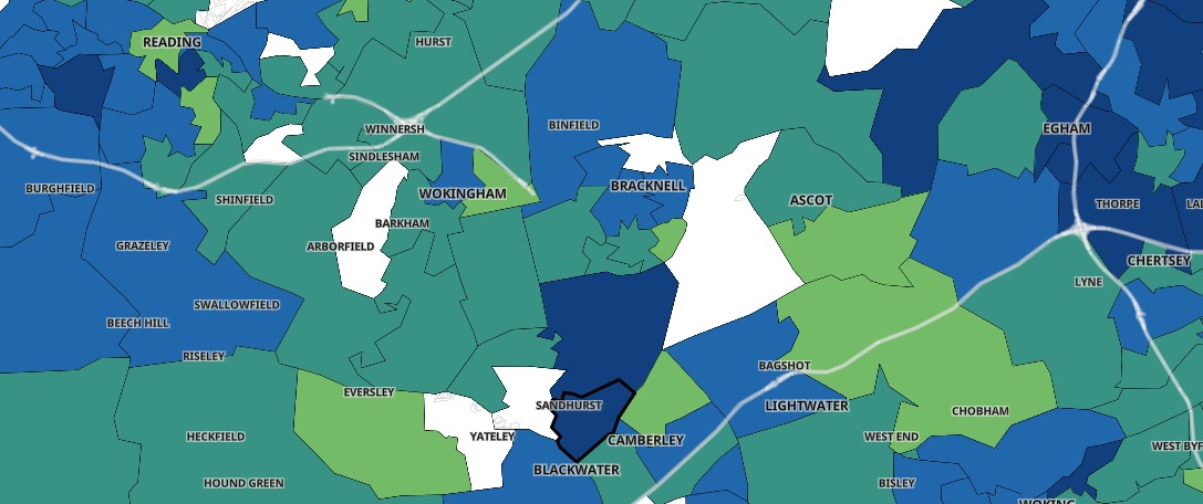
Covid map
The areas are:
- Chavey Down & North Ascot West
- Wick Hill
- Sandhurst
Other areas with very low infection rates (lightest green) include:
- Crown Wood
Here's another image of the map that shows coronavirus cases in the same area a month ago (the week up to January 15):
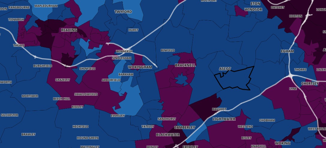
Covid map
The comparison shows how infection rates in nearly every part of Bracknell Forest has dropped significantly.
Here's a look at how coronavirus has spread over lockdown.
Last week, we revealed exactly where the coronavirus hotspots are in the borough.
Maps show that the College Town postcode area currently has the most cases with 28 people infected with Covid-19.


Comments: Our rules
We want our comments to be a lively and valuable part of our community - a place where readers can debate and engage with the most important local issues. The ability to comment on our stories is a privilege, not a right, however, and that privilege may be withdrawn if it is abused or misused.
Please report any comments that break our rules.
Read the rules here